English | 5hr 50m | Video: 720p | Project files | 4.77 GB
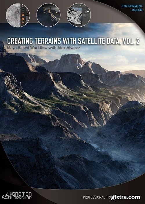
In this second title of a two-part series, Alex Alvarez continues his demonstration of utilizing satellite data to develop terrains. Where Volume One developed the skills necessary for high-altitude cameras, Volume Two focuses on techniques that allow the artist to effectively 'up-rez' regions of the terrain. Adding ZBrush to the workflow, Alex identifies areas that would benefit from digital sculpting. New geometry is created from the initial satellite DEM file (Digital Elevation Model) that is topologized, UV'd, then sculpted using ZBrush's HD Geometry.
The procedural rock textures generated in Volume One are now used as ZBrush Alphas to quickly sculpt rock and cliff details. In addition to HD ZBrush workflows, Alex also shows an alternate approach that allows us to utilize DEMs directly in ZBrush, as well as how to use Decimation Master and XNormal to generate high-quality results. Once the ZBrush phase is complete, new satellite photos are then acquired using Google Earth Pro to generate 8k and 16k textures. Alex demonstrates how to align and project these new textures onto the new terrain geometry in Maya as well as how to cleanup textures using Mari, which supports 16k texture workflows, in a manner suitable for artists with no Mari experience. With models and textures complete, Alex shares his alternate lighting strategies. While Physical Sun/Sky offers convenience, an HDR workflow, combined with direct lighting, offers far more creative control. Alex then moves on to his techniques for creating Atmospheric effects, such as air and fog. Volume Primitives are thoroughly explained including how to texture their density for patchy fog effects. Lastly, rendering the various passes is discussed and the lecture concludes with a demonstration of how to combine the various passes in Photoshop to tune the final look of the image. For artists interested in creating natural environments with Maya, this title provides a variety of powerful techniques to create worlds both real and imagined. Home Page - https://www.thegnomonworkshop.com/tutorials/creating-terrains-with-satellite-data-volume-2 
TO MAC USERS: If RAR password doesn't work, use this archive program:
RAR Expander 0.8.5 Beta 4 and extract password protected files without error.
TO WIN USERS: If RAR password doesn't work, use this archive program:
Latest Winrar and extract password protected files without error.
SermonBox - Seasonal Collection

SermonBox - The Series Pack Collection
Top Rated News


Would you like to be a Author?